First of all please accept my apologies for typing in English. I’m an English hiker. I’m afraid that if I use auto translate it may not be accurate.Anyway, I’m hiking south to north. I started on 1st June. I had studied all the maps a lot in order to build an alternative start to the GTA for myself, mainly due to the closure of the first (or last if you go north-south) refuges being closed. I thought it might be helpful if I share my route. I can add gpx links if anyone is interested.
Here are my 6 stages which go from the sea up to Limone. We set off on 1st June and have only passed 2 other hikers on route, and they were locals out for a day walk.
1Bordighera to Seborga 10km 520m ascent. This was a wonderful way to start. Starting right from a lovely park above the small peninsula of Capo sant Ampelio and going through Bordighera old town. Seborga ist ein Hügeldorf, atemberaubender Lage und eine interessante Geschichte.
-
Seborga to Bajardo 14.5km 790m We stayed above Bajardo in a wonderful B&B called B&B Camelie del Bosco. Incredible views down to Bajardo. The kind owner Valeria will cook a simple supper if you ask in advance. She is very keen to host more hikers. They are on Booking but they’d prefer you to contact them directly. Details on their website http://www.cameliedelbosco.it
-
Bajardo to Colle Melosa (Rif Allevena) 22km 1,050m ascent, 570 descent. A long day with some road walking. I think that work best to be split into two and arrange a pick up/drop off by staying longer at the B&B Camelie del Bosco. San Giovanni dei Prati would make an excellent pick up/drop off. The B&B is happy to help with lifts to and from points on the hike, as long as you prearrange.
-
Colle Melosa to Rifugio La Terza. 18km, 1,000m ascent 530m descent. Don’t be put off by the sign about the seriousness of the path up to Monte Sacarello. It is well made and safe except the usual caution in bad weather. There is an easy way on tracks that takes 5km more.
-
Rifugio La Terza to Rifugio Don Barbera 17km 840m ascent 770m descent. We went along the ridge path that goes past Monte Bertrand - it is stunning and a well made old mule path! Highly recommend taking this route; it was one of the best walks I’ve done. There is also an easy way on the big track all the way, although it’s 5km longer.
6 Rifugio Don Barbera to Limone. 18km 233m ascent 1,353m descent. We descended directly from Col di Boaria to Limone. Enjoyed this route as we avoided seeing any of the ski infrastructure. (From Limone we took the train to Cuneo and enjoyed 2 rest days before taking the train back to resume our walk).
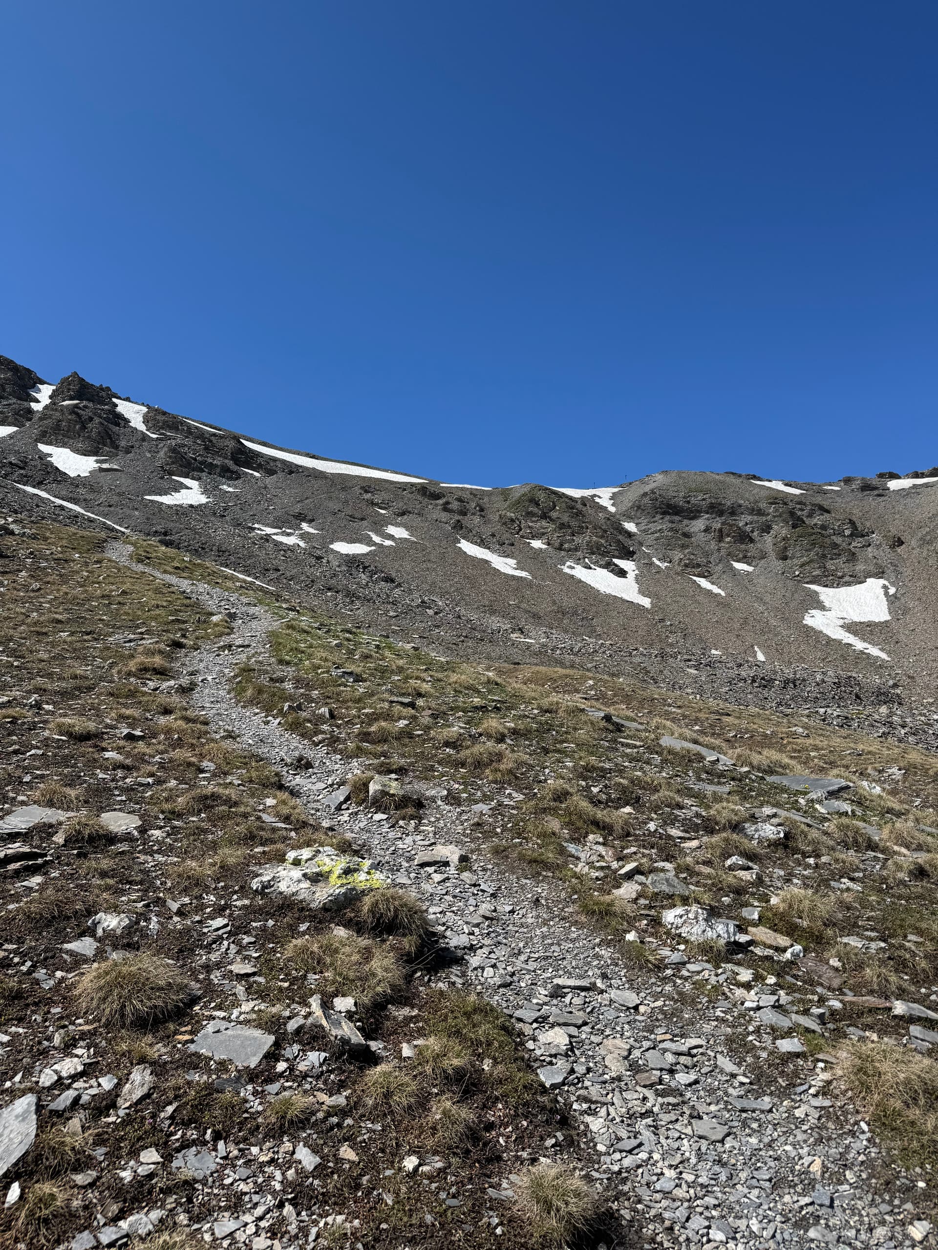
The highest we’ve been at so far was 2,400m on Mont Bertrand and there were some small snow patches above 2,300m but just v small and easy to walk around. As I type this now, 6 days later, I imagine the patches have almost gone.
The final thing to note is that the salt roads, the ones where motorbikes and 4x4 cars go, are currently closed to all motor vehicles. It is too early in the year for them. So all these tracks in the mountains are quiet.
Hope this is useful and please let me know if you have any questions or would like gpx tracks.
Sorry again for writing in English.
Flora